Two high tides and two low tides a day, spring and neap tides, and why you should not wade across the lagoon. Charts with the next 7 and 30 days and what the authorities recommend.
In Cacela Velha, your beach day depends on the tide. The Ria Formosa fills and empties every day, sandbanks appear and disappear, and the currents in the channels change with it. This guide explains how to read a tide table, shows the forecast for the coming days at the nearest bar and sums up what the authorities recommend for anyone heading to the beach.
Quick answer
- Four tides a day: there are normally two high tides and two low tides each day, and each one arrives about 40 to 50 minutes later than the day before.
- Do not wade across the lagoon: the municipality of Vila Real de Santo António and the National Maritime Authority advise against crossing on foot to the barrier islands, especially on the ebb, when currents are stronger. There are no lifeguards in that area.
- A supervised beach: the municipality points to Praia da Fábrica and Manta Rota beach as alternatives, with lifeguards.
- To check the tides: use the charts on this page as a guide and the official Instituto Hidrográfico tables to decide.
These charts are an indicative astronomical forecast. They are not for navigation or for deciding whether anything is safe in the lagoon.
Tides for the next 7 days
| Day | Tides (time · height) | Range |
|---|---|---|
| Wednesday October 21 neap tides | LT 05:40 · 1.4 mHT 11:52 · 2.7 mLT 18:14 · 1.1 m | 1.6 m |
| Thursday October 22 | HT 00:26 · 2.7 mLT 06:24 · 1.2 mHT 12:35 · 2.9 mLT 18:50 · 0.9 m | 1.9 m |
| Friday October 23 | HT 01:03 · 2.9 mLT 07:01 · 1.0 mHT 13:13 · 3.1 mLT 19:24 · 0.7 m | 2.3 m |
| Saturday October 24 spring tides | HT 01:36 · 3.0 mLT 07:36 · 0.8 mHT 13:48 · 3.2 mLT 19:56 · 0.6 m | 2.6 m |
| Sunday October 25 spring tides | HT 01:10 · 3.2 mLT 07:10 · 0.6 mHT 13:24 · 3.3 mLT 19:30 · 0.5 m | 2.9 m |
| Monday October 26 spring tides | HT 01:44 · 3.3 mLT 07:46 · 0.5 mHT 14:01 · 3.4 mLT 20:05 · 0.4 m | 3.0 m |
| Tuesday October 27 spring tides | HT 02:20 · 3.4 mLT 08:24 · 0.4 mHT 14:39 · 3.4 mLT 20:42 · 0.4 m | 3.0 m |
The chart shows the forecast for the Guadiana bar at Vila Real de Santo António, the nearest reference station to Cacela Velha. Inside the lagoon the tide arrives later and the height can differ. See the Ria Formosa guide to understand how the lagoon works.
How to read a tide table
- High tide (HT): the highest water level. Low tide (LT): the lowest.
- Height: given in metres above chart datum, the reference of the tables (close to the lowest astronomical tide). A low tide of 0.4 m, for example, is 40 cm above that zero.
- Range: the difference between the day's high and low tide. The bigger it is, the more the water rises and falls.
- Times: the charts use local time.
Spring tides and neap tides
The range changes through the month. Spring tides have bigger ranges and happen around the new moon and the full moon, with a delay of one or two days. Neap tides have smaller ranges and happen around the quarter moons. In spring tides the water rises more and falls more, so more sand is exposed and currents in the channels are stronger.
Tidal range over the next 30 days
Why the tide matters in Cacela Velha
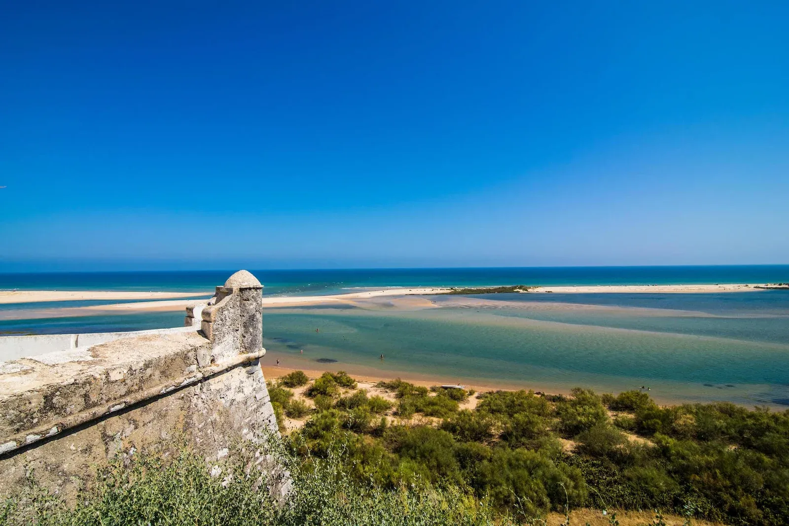
The village sits on the Ria Formosa, a lagoon of barrier islands, channels and salt marshes where the tides redraw the landscape twice a day. Cacela Velha beach is on the other side of the lagoon and the usual way to reach it is by boat from Sítio da Fábrica, in a seasonal service. See the guide how to get to Cacela Velha beach and the beach guide.
What the authorities say about crossing on foot
- July 2023: in a press release, the Vila Real de Santo António municipality advised against using the beach in front of Cacela Velha. According to Lusa, the barrier islands are not a bathing area and have no permanent lifeguard service, and anyone wading across the lagoon, especially on the ebb, puts their own safety at risk because currents are strong and pull towards the sea.
- August 2025: the Municipal Civil Protection Service and the National Maritime Authority held an awareness campaign in Cacela Velha. According to Postal do Algarve, the municipality considers crossing on foot a considerable risk and says the SeaWatch project recorded about 60 rescue operations in the area between June and October 2024. The municipality recommended Praia da Fábrica and Manta Rota beach.
This information comes from the press and may have changed: check with the municipality or the harbour master before you go.
What to do in practice
- Check the tide before planning the day. Consult the official Instituto Hidrográfico table and use the chart above to see the times of high and low tide.
- Go by boat to the beach in front of the village and check the times at Sítio da Fábrica, because the service is seasonal.
- If you prefer a supervised beach, choose Manta Rota beach, with direct access, and check when lifeguards are on duty.
- Do not walk across sandbanks or channels, least of all with children. The tide changes and so do the currents.
- In an emergency, call 112. For families, see also Algarve with kids.
Sources
- Forecast: Sabido, tides at Vila Real de Santo António, calculated with the global tide model EOT20 (DGFI-TUM, CC BY 4.0).
- Official tables: Instituto Hidrográfico.
- Lusa / Notícias ao Minuto, 5 July 2023: Autarquia desaconselha utilização de praia da Cacela Velha.
- Postal do Algarve, 4 August 2025: Cacela Velha: resgates sucessivos levam município de VRSA a renovar apelo à precaução.
Frequently asked questions
How many tides are there a day in Cacela Velha?
Normally two high tides and two low tides a day. Each one arrives about 40 to 50 minutes later than the day before.
What are spring tides and neap tides?
Spring tides have bigger ranges and happen around the new moon and the full moon, with a delay of one or two days; neap tides have smaller ranges and happen around the quarter moons. In spring tides more sand is exposed and currents in the channels are stronger.
Can I wade across the lagoon to Cacela Velha beach?
It is not recommended. The municipality of Vila Real de Santo António and the National Maritime Authority advise against crossing on foot, especially on the ebb, when currents are stronger, and there are no lifeguards on the barrier islands. Prefer the boat from Sítio da Fábrica or a supervised beach such as Manta Rota.
Where do I find the official tide table?
The Instituto Hidrográfico publishes the official tide tables. The charts on this page are an indicative astronomical forecast for the Guadiana bar at Vila Real de Santo António and do not replace the official tables.